Resource Overview
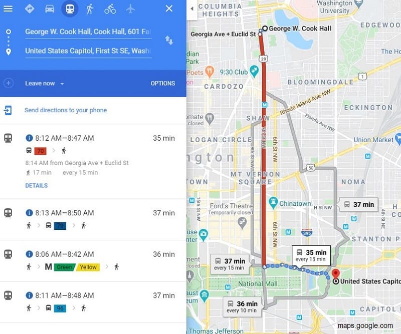
Students use interactive mapping to strategize urban transit and determine the most convenient ways for people to get around a city, and then use emissions data to extrapolate the impact of thousands of individual travel choices.
Students will be able to:
- Use an online mapping tool to calculate transit times between various locations.
- Interpret small-scale data and extrapolate meaning for large populations.
- Compare and contrast the benefits and drawbacks of different types of transit for both people and the environment.
Features of This Resource
- Great lesson for distance learning
- Students consider how their personal choices and actions fit into Earth’s changing climate
- Students pretend to be a college freshman and use Google Maps to compare transit options in their new city

How Do I Get This Lesson Plan?
The resource is free. Click the green button for immediate download. Download Now
Other Resources You Might Like:
Students create and conduct a survey to identify a local transportation issue and develop a strategy to make their community... Read more »
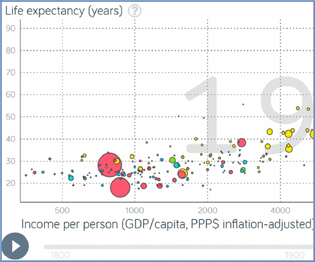
Using the ‘trendalyzer’ program from www.gapminder.org, students construct and interpret dynamic graphs and discuss differences in life expectancy, fertility rates,... Read more »

Explores how the amount of carbon emitted and vulnerability to climate-related risks varies between countries.
Nice to meet you!
Tell us a bit about yourself so we can continue creating resources that meet your needs.
You’ll only need to fill out this form once. If you’ve already completed the form, you can confirm your email here.