Tool
6-8, 9-12
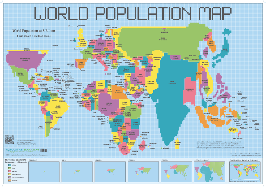
World Population Map poster
The poster is available for purchase in our store.
Purchase NowThe World Population Map is a cartogram poster providing students a unique view of the Earth – the size of each country is shown in proportion to its population, rather than its land mass. Colorful squares are arranged to represent the 2022 global population of 8 billion people. The map is a powerful teaching tool for student exploration of how population data can be visually interpreted and how different map types can alter the perspective of how one sees the world.
These lessons in the Map Activity Guide have been designed primarily for the high school social studies classroom but all are interdisciplinary, relying on and applying knowledge and skills from mathematics, English language arts, and science.
Features of This Resource
- 35″ x 50″ human population cartogram poster
- Map Activity Guide includes a background reading and two classroom lesson plans
- Opportunity for learners of all ages to work with geographic representations
- Students practice geo-literacy and quantitative literacy
Accompanying Lesson Plans
The following are included with the downloadable Activity Guide:
Lesson Plans
Population Squared
-
Students analyze, interpret, and evaluate conclusions on population data from the World Population Map, and then construct their own population cartogram.
Land Use Squared
-
Students compare the World Population Map with an equal area map to calculate statistics related to urbanization and arable land.
Reading
Mapping Population
-
Overview of population cartogram: what is it, when it's used, and limitations.
Lesson Plans
Population Squared
- Students analyze, interpret, and evaluate conclusions on population data from the World Population Map, and then construct their own population cartogram.Land Use Squared
- Students compare the World Population Map with an equal area map to calculate statistics related to urbanization and arable land.Reading
Mapping Population
- Overview of population cartogram: what is it, when it's used, and limitations.Supplemental Materials

How Do I Get This Poster?
The poster is available for purchase in our store. Purchase Now
Other Resources You Might Like:
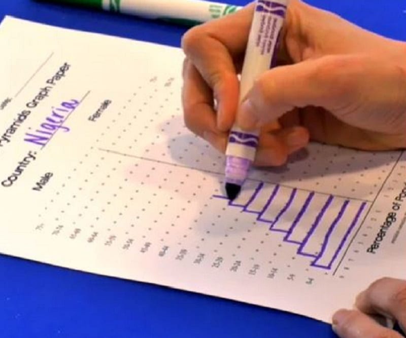
Students use real-world data to construct and interpret population pyramids and discuss differences in population growth rates among several different... Read more »

High school lessons cover global interdependence in ways students find meaningful and relatable.
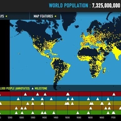
Interactive map of world population growth with annotated population "dots," data overlays, and thematic timelines.
Nice to meet you!
Tell us a bit about yourself so we can continue creating resources that meet your needs.
You’ll only need to fill out this form once. If you’ve already completed the form, you can confirm your email here.